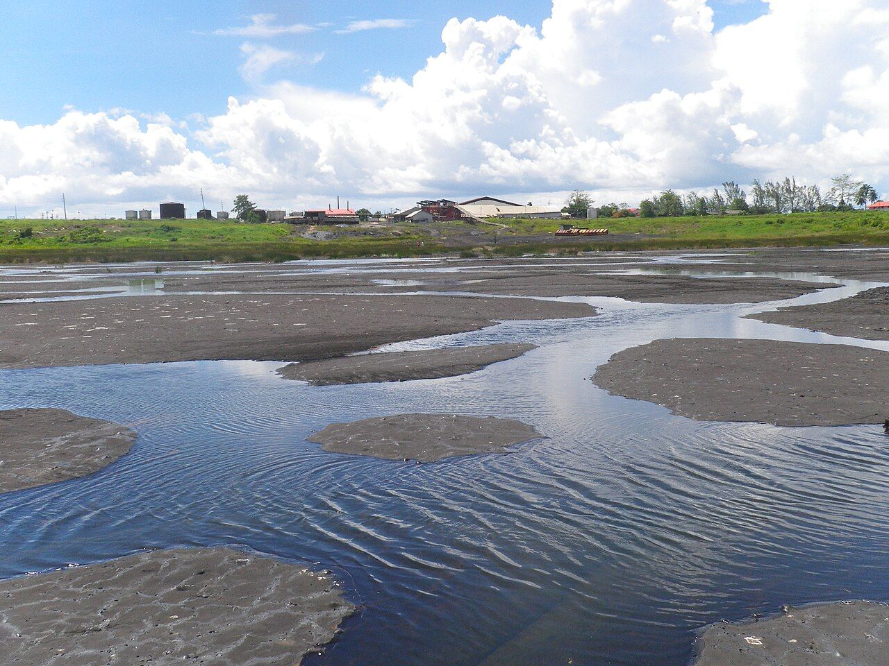
In the far southwest of Trinidad, at the village of La Brea, the ground gives way to something unusual: a broad, grey, wrinkled surface that looks at first like a dried-out mudflat. It is the Pitch Lake, a natural deposit of asphalt widely described as the largest in the world. You can walk out across much of it, feeling the surface give very slightly underfoot, and step between pools of warm water lying in its folds. It is strange, a little otherworldly, and an easy, rewarding half day.
What the Pitch Lake is
The lake sits over a seep where heavy oil rises from deep underground and mixes with clay and water, forming asphalt. Over thousands of years this has built up into a shallow basin many metres deep, covering a large area that looks from the edge like a grey plain. The surface moves very slowly, like an extremely thick liquid: objects dropped on it can be swallowed over years, and the centre of the lake is softer and more active than the edges.
Asphalt from the lake has been dug and exported for well over a century, used to pave roads in many countries. Mining still goes on at the edges, and the industrial buildings you see around the rim are part of that long working life. Despite the digging, the lake slowly refills from below.
Walking on the lake
Visits are made with a guide, arranged at the visitor centre beside the lake. The guides know where the surface is firm and where it is soft, and they lead small groups out along a safe route, pointing out the pools, gas bubbles and plants that grow in the cracks. Fees and opening hours change, so check before you go. Going without a guide is not wise: soft spots are not always obvious, and you can sink to the ankle or deeper.
Wear closed shoes that you do not mind marking, as pitch can stick to soles. In the heat of the day the surface warms and softens, so a morning visit is more comfortable for walking and for the sun. Bring a hat and water; there is little shade out on the lake.
The pools
Rainwater collects in hollows across the surface, forming pools that range from a few centimetres to over a metre deep. Some carry a faint smell of sulphur and a yellowish tinge from minerals. Local people have long bathed in them, and many believe the water eases skin and joint complaints; you may be invited to dip your feet or more. If you do, ask the guide which pools are suitable, enter slowly, and rinse off afterwards.
In the dry season, roughly January to May, the pools shrink and more of the surface is exposed, making the walk easier. In the wet season the lake can be heavily pooled, which is attractive but means more wading. Water lilies and small fish appear in some of the longer-lasting pools, and wading birds stop to feed.
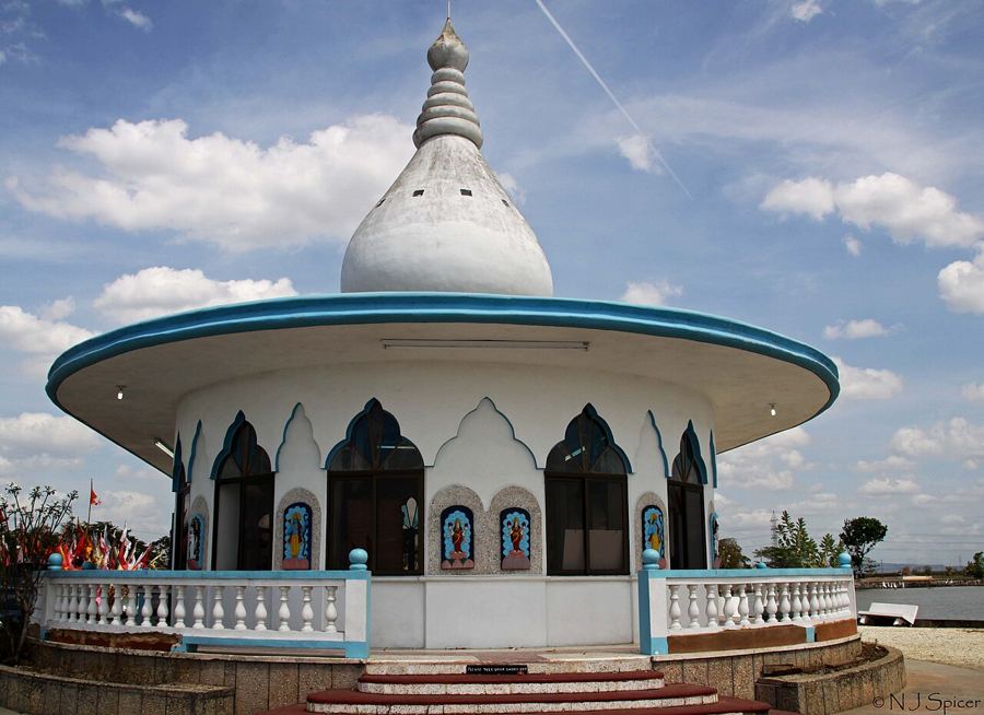 Another lime · Central and southThe Temple in the Sea and central Trinidad
Raleigh, legends and history
The lake has been known for a very long time. Indigenous people of the island used the pitch, and European sailors found it early; Sir Walter Raleigh, passing through in the 1590s, is said to have used it to caulk his ships. Local legend explains the lake's origin as a punishment from the gods after the Chaima people killed sacred hummingbirds, which they believed held the souls of their ancestors. It is a story still told at the lakeside, and a reminder that hummingbirds are a deep symbol of the island.
A small museum at the visitor area covers the lake's science and history in general terms. Its opening days may vary.
Oil and the south
South Trinidad has been oil country since the early twentieth century. As you drive through towns such as Point Fortin and Fyzabad you pass pumping jacks nodding in fields, pipelines along the roadside and the remains of old refineries. Oil and gas built much of the country's modern economy, and the industry's history is woven into the labour movement and politics of the island. The landscape is very different from the forested north: flatter, with mixed farmland, scrub and working towns.
The coast road along the Gulf of Paria gives glimpses of fishing boats and offshore installations. Pair the lake with a slow drive here, or continue east toward Mayaro and the quiet southeast if you have the time.
San Fernando Hill
On the way back north, San Fernando, the country's second city, rises around a single hill. San Fernando Hill was long quarried, which gave it its odd, cut-away shape, but it is now a protected park with paths, lookouts and shaded spots. From the top you see the city spread out below, the gulf beyond, and on clear days the long, flat country stretching toward central Trinidad.
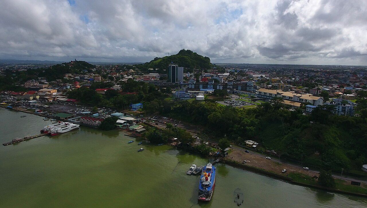
The hill is a favourite with local families on weekend afternoons, and it makes a calm end to a day in the south. Gates and opening hours can vary, so check before you go. The city also has a waterfront where ferries link San Fernando with Port of Spain across the gulf, which is covered in getting around Trinidad.
Planning the day
La Brea is a long drive south from Port of Spain, usually a couple of hours or more depending on traffic, which can be heavy on weekday mornings. Many people combine the lake with a stop at the Temple in the Sea on the way down or back. Eat a good breakfast, travel early, and plan to be off the lake before midday.